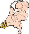
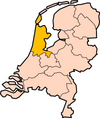
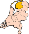
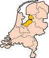
File:Limburg-Position.png
From OpenMedia
Limburg-Position.png (200 × 235 pixels, file size: 23 KB, MIME type: image/png)
| This media item is originally from http://commons.wikimedia.org/wiki/File:Limburg-Position.png, last uploaded by Snowdog; it was copied to a local repository as a caching mechanism to speed up page rendering and to prevent links to break when media items are renamed on commons. For a full list of earlier authors and contributors please refer to the file version history and the metadata version history in the repository from which this media item has been copied.
Below you find the original information from the metadata page at the time of copying (2021-12-05, 23:27): |
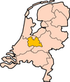
Description: Map for localisation of the province of Limburg in the Netherlands.
Clickable version

|
Permission is granted to copy, distribute and/or modify this document under the terms of the GNU Free Documentation License, Version 1.2 or any later version published by the Free Software Foundation; with no Invariant Sections, no Front-Cover Texts, and no Back-Cover Texts. A copy of the license is included in the section entitled GNU Free Documentation License.
|
| |
This file is licensed under the Creative Commons Attribution-Share Alike 3.0 Unported license. | |
| ||
| This licensing tag was added to this file as part of the GFDL licensing update. |
File history
Click on a date/time to view the file as it appeared at that time.
| Date/Time | Thumbnail | Dimensions | User | Comment | |
|---|---|---|---|---|---|
| current | 23:27, 5 December 2021 | 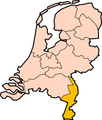 | 200 × 235 (23 KB) | Media-caching-bot (Talk | contribs) | {{Cached Commons Copy|file=Limburg-Position.png|lastuploader=Snowdog|time=2021-12-05, 23:27}} '''Description:''' Map for localisation of the province of Limburg in the Netherlands. ==Clickable version== <imagemap> Image:Limburg-Position.png default Netherlands poly 20 144 59 101 65 104 65 111 71 108 81 113 77 118 80 126 78 131 83 136 89 130 97 129 93 140 84 143 77 146 63 154 54 153 55 160 46 160 South Holland poly 58 103 66 38 78 30 89 34 103 72 90 97 107 106 100 107 97 113 93 110 91 103 86 103 80 110 71 107 65 109 65 103 North Holland poly 71 29 122 0 159 -1 145 7 149 16 145 31 1 |
- You cannot overwrite this file.
File usage
The following 12 pages link to this file:
- File:Drenthe-Position.png
- File:Flevoland-Position.png
- File:Friesland-Position.png
- File:Gelderland-Position.png
- File:Limburg-Position.png
- File:Netherlands with provinces.png
- File:Noord Brabant-Position.png
- File:Noord Holland-Position.png
- File:Overijssel-Position.png
- File:Utrecht-Position.png
- File:Zeeland-Position.png
- File:Zuid Holland-Position.png


