File:BlankMap-World.svg
From OpenMedia

Size of this preview: 800 × 406 pixels. Other resolution: 320 × 162 pixels.
Original file (SVG file, nominally 2,754 × 1,398 pixels, file size: 1.05 MB)
| This media item is originally from http://commons.wikimedia.org/wiki/File:BlankMap-World.svg, last uploaded by L.tak; it was copied to a local repository as a caching mechanism to speed up page rendering and to prevent links to break when media items are renamed on commons. For a full list of earlier authors and contributors please refer to the file version history and the metadata version history in the repository from which this media item has been copied.
Below you find the original information from the metadata page at the time of copying (2021-03-21, 11:50): |
|
|
This image is expected to be always the most recent one. Feel free to update it when needed.
|
Summary
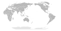
| Description | English: A detailed Robinson projection SVG map with grouping enabled to connect all non-contiguous parts of a country's territory for easy colouring. Smaller countries can also be represented by larger circles to show their data more clearly. A thorough description of use and other instructions relating to this can be found on the instructions page.
Русский: Современная политическая карта мира (бланк) в проекции Робинсона, сохранённая в векторном формате SVG, в котором территориально-разделённые части государств (острова, анклавы, заморские владения и другие) сгруппированы вместе — и таким образом легко окрашивать всю группу одним цветом. Малые страны, не отображающиеся или отображающиеся слишком мелко на карте мира в таком масштабе, на производных картах могут быть также отображены в виде кругов (на этой карте круги присутствуют в виде прозрачных невидимых элементов изображения). Более подробное описание и рекомендации по использованию смотрите в документации файла (англ.). |
||
| Date | (original upload date) | ||
| Source | Adapted from + which was originally based on CIA's 2005 political world map (a vector-based PDF file which can now be found in Perry–Castañeda Library Map Collection). | ||
| Author | Canuckguy (talk) and many others (see File history) | ||
| Permission (Reusing this file) |
|
||
| Other versions |
Derivative works of this file:
|
File history
Click on a date/time to view the file as it appeared at that time.
| Date/Time | Thumbnail | Dimensions | User | Comment | |
|---|---|---|---|---|---|
| current | 11:50, 21 March 2021 |  | 2,754 × 1,398 (1.05 MB) | Media-caching-bot (Talk | contribs) | {{Cached Commons Copy|file=BlankMap-World.svg|lastuploader=L.tak|time=2021-03-21, 11:50}} {{Notice|{{Multilingual description |en='''Editor's note:''' * This map is saved in human-editable plain text format. Please do '''not''' upload edits directly saved with Inkscape. * When making a {{Derivative}}, it is better to keep the Earth's outline, and consider using properly centered map with proper projection when making a regional map. See the discussion. * When you upload a new version of this file, you irrevocably agree to release your modified version to the public domain. If you do not agree to release your modified version to the public domain, you may upload it as a new file and license it unde |
- You cannot overwrite this file.
File usage
The following 3 pages link to this file:


