File:BlankMap-World-v5-BeforeKosovo.png
From OpenMedia

Size of this preview: 800 × 351 pixels. Other resolutions: 320 × 140 pixels | 1,425 × 625 pixels.
Original file (1,425 × 625 pixels, file size: 26 KB, MIME type: image/png)
| This media item is originally from http://commons.wikimedia.org/wiki/File:BlankMap-World-v5-BeforeKosovo.png, last uploaded by NerdyNSK; it was copied to a local repository as a caching mechanism to speed up page rendering and to prevent links to break when media items are renamed on commons. For a full list of earlier authors and contributors please refer to the file version history and the metadata version history in the repository from which this media item has been copied.
Below you find the original information from the metadata page at the time of copying (2016-09-18, 23:30): |
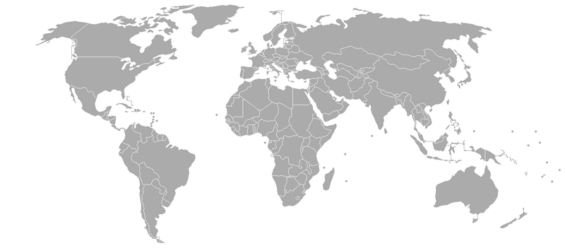
| Description | The world, as it was before USA and other countries recognised the Kosovo's declaration of independence.
Version of Image:BlankMap-World-v4.png using thin lines to join areas owned by the same country Please overlay with a white layer or ocean layer after bucket-filling to hide the lines. This can be done in a program such as GIMP. Commons talk page gives list of co-ords and instructions for a way of doing automated bucket-filling and creating a GIMP script to use with them. If you plan on generating a new map for wikipedia by zooming in on this map and making some modifications, please consider a source map in SVG format instead, which can produce a higher quality image. These can be found in the SVG section at Wikipedia:Blank Maps. |
| Date | 2008-09-12 22:55 (UTC) |
| Source | |
| Author |
|
| This is a retouched picture, which means that it has been digitally altered from its original version. Modifications: deleted Kosovo border. The original can be viewed here: BlankMap-World-v5.png. Modifications made by NerdyNSK.
|
|
Original upload log
This image is a derivative work of the following images:
- Image:BlankMap-World-v5.png licensed with GFDL
- 2008-09-12T22:50:51Z NerdyNSK 1425x625 (26781 Bytes) fixed FYROM border
- 2008-02-25T20:16:29Z Nightstallion 1425x625 (48229 Bytes) Reverted to version as of :, 0 <>
- 2008-02-25T19:59:13Z Cp6 1425x625 (48239 Bytes) Reverted to version as of :, 0 <>
- 2008-02-25T11:16:08Z Nightstallion 1425x625 (48229 Bytes) Reverted to version as of :, 0 <>
- 2008-02-24T13:39:31Z Cp6 1425x625 (48239 Bytes) Reverted to version as of :, 0 <>
- 2008-02-24T12:45:26Z Nightstallion 1425x625 (48229 Bytes) Reverted to version as of :, 0 <>
- 2008-02-23T22:29:15Z Cp6 1425x625 (48239 Bytes) No OVERWRITING, look disc
- 2008-02-23T10:53:02Z Nightstallion 1425x625 (48229 Bytes) Reverted to version as of :, 0 <>
- 2008-02-22T22:12:18Z Cp6 1425x625 (48239 Bytes) It isn't internationally recognized, look [[Image:Kosovo relations.png]]
- 2008-02-18T23:16:27Z Hoshie 1425x625 (48229 Bytes) Added Kosovo since it has been internationally recognized.
- 2007-11-10T04:07:01Z Hoshie 1425x625 (48239 Bytes) re-drew Cabinda (Angola); under same lic. as before.
- 2007-11-05T05:06:54Z Wiz9999 1425x625 (48239 Bytes) Corrected proportions to correlate with BlankMap-World.png
- 2007-04-18T18:31:12Z Wiz9999 1357x628 (47118 Bytes) Connected [[Nakhichevan]] to the rest of [[Azerbaijan]].
- 2007-04-10T23:53:57Z Hoshie 1357x628 (47116 Bytes) re-added Nakhichevan.
- 2007-01-28T05:10:49Z Wiz9999 1357x628 (47158 Bytes)
- 2007-01-28T04:50:06Z Wiz9999 1357x628 (47158 Bytes) Adding earlier edits to Cabinda edit
- 2007-01-21T19:19:55Z Tene 1357x628 (18625 Bytes) Optimised (no filter)
- 2006-12-13T21:09:44Z Hoshie 1357x628 (47141 Bytes) added Cabinda. under same license as orginal.
- 2006-12-10T20:46:51Z Wiz9999 1357x628 (47133 Bytes) Bahamas
- 2006-12-10T20:34:30Z Wiz9999 1357x628 (47075 Bytes) Removed some outlying French Pacific Islands (Part of France)
- 2006-12-10T19:41:05Z Wiz9999 1357x628 (47113 Bytes) Reverted to earlier revision. That devision does not contribute to the 'one click' nature of the map.
- 2006-10-21T21:30:34Z Hoshie 1357x628 (47116 Bytes) added a line between Nakhichevan and Armenia. Under same license as orginial.
- 2006-10-10T14:19:14Z Dbachmann 1357x628 (47100 Bytes) Reverted to earlier revision
- 2006-06-28T01:54:47Z Roke 1350x625 (57016 Bytes) few changes to keep in line with the ocean/white layers
- 2006-06-07T16:00:32Z Roke 1357x628 (47100 Bytes) minor - alaskan island not joined
- 2006-06-05T02:35:26Z Roke 1357x628 (47154 Bytes) montenegro independent
- 2006-03-25T08:14:26Z Roke 1357x628 (47153 Bytes) Version of [[:Image:BlankMap-World-v4.png]] using thin lines to join areas owned by the same country [[Category:Blank world maps]]
File history
Click on a date/time to view the file as it appeared at that time.
| Date/Time | Thumbnail | Dimensions | User | Comment | |
|---|---|---|---|---|---|
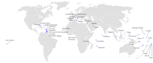
| current | 22:30, 18 September 2016 |  | 1,425 × 625 (26 KB) | Media-caching-bot (Talk | contribs) | {{Cached Commons Copy|file=BlankMap-World-v5-BeforeKosovo.png|lastuploader=NerdyNSK|time=2016-09-18, 23:30}} {{Information |Description=The world, as it was before USA and other countries recognised the Kosovo's declaration of independence. Key to the dots denoting small countries Version of Image:BlankMap-World-v4.png using thin lines to join areas owned by the same country Please overlay with a white layer or ocean layer after bucket-filling to hide the lines. This can be done in a program such as GIMP. Commons talk page gives list of co-ords and instructions for a |
- You cannot overwrite this file.
File usage
There are no pages that link to this file.


