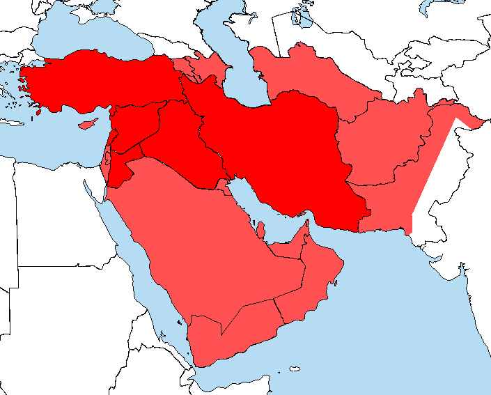
File:Archaeology of the Ancient Near East.png
From OpenMedia
Archaeology_of_the_Ancient_Near_East.png (705 × 567 pixels, file size: 28 KB, MIME type: image/png)
| This media item is originally from http://commons.wikimedia.org/wiki/File:Archaeology_of_the_Ancient_Near_East.png, last uploaded by Schar Kischschatim; it was copied to a local repository as a caching mechanism to speed up page rendering and to prevent links to break when media items are renamed on commons. For a full list of earlier authors and contributors please refer to the file version history and the metadata version history in the repository from which this media item has been copied.
Below you find the original information from the metadata page at the time of copying (2021-07-18, 04:42): |
| Description |
|
| Date | 2010-06-01 22:54 (UTC) |
| Source | |
| Author |
|
|
Original upload log
This image is a derivative work of the following images:
- File:A_large_blank_world_map_with_oceans_marked_in_blue.PNG licensed with Cc-by-sa-2.5,2.0,1.0, Cc-by-sa-3.0-migrated, GFDL
- 2008-03-22T21:59:22Z Nightstallion 4500x2234 (377544 Bytes) Reverted to version as of 16:38, 13 March 2008
- 2008-03-19T19:35:21Z Patstuart 4500x2234 (377510 Bytes) Reverted to version as of 18:22, 11 March 2008 - see [[Image talk:BlankMap-World-v6.png#As stated in reversion]]
- 2008-03-13T16:38:41Z Nightstallion 4500x2234 (377544 Bytes)
- 2008-03-11T18:22:23Z Avala 4500x2234 (377510 Bytes) there must be international consensus to show this as a final border. shading would be the best solution or stripes
- 2008-02-25T20:14:05Z Nightstallion 4500x2234 (377544 Bytes) Reverted to version as of :, 0 <>
- 2008-02-25T19:56:42Z Cp6 4500x2234 (377510 Bytes) Reverted to version as of :, 0 <>
- 2008-02-25T11:19:27Z Nightstallion 4500x2234 (377544 Bytes) Reverted to version as of :, 0 <>
- 2008-02-24T13:43:26Z Cp6 4500x2234 (377510 Bytes) Reverted to version as of :, 0 <>
- 2008-02-24T12:48:31Z Nightstallion 4500x2234 (377544 Bytes) Reverted to version as of :, 0 <>
- 2008-02-23T22:32:52Z Cp6 4500x2234 (377510 Bytes) No OVERWRITING, look disc
- 2008-02-23T09:04:40Z Nightstallion 4500x2234 (377544 Bytes) Reverted to version as of :, 0 <>
- 2008-02-23T00:10:35Z Cp6 4500x2234 (377510 Bytes) No UN seat no map seat
- 2008-02-22T23:29:41Z Nightstallion 4500x2234 (377544 Bytes) Reverted to version as of :, 0 <>
- 2008-02-22T22:18:50Z Cp6 4500x2234 (377510 Bytes) It isn't internationally recognized, look [[Image:Kosovo relations.png]]
- 2008-02-22T20:58:31Z Hoshie 4500x2234 (377544 Bytes) added Kosovo
- 2007-03-11T10:39:12Z Hoshie 4500x2234 (377510 Bytes) small touchup and fixes in NW Yemen. Under same license as organial.
- 2007-03-11T10:11:08Z Hoshie 4500x2234 (377503 Bytes) Fixed some geographical problems: Namibia, Gaza, Germany, Yemen, and Serbia. See talk page.
- 2006-11-27T02:03:46Z Roke 4500x2234 (377922 Bytes) better version derived from svg
- 2006-07-20T02:13:59Z Roke 4500x2234 (107296 Bytes) islands north of canada
- 2005-12-29T22:16:23Z Denniss 4500x2234 (202816 Bytes) less bright ocean color, simplified some areas to make easier to color countries, uploaded by [[User:Astrokey44]] under wrong name
- 2005-11-10T08:05:52Z Roke 4500x2234 (208808 Bytes) caspian sea
- 2005-11-10T06:02:54Z Roke 4500x2234 (208726 Bytes) Blank world map I traced from the public domain CIA map on w: world map, showing oceans and seas in blue. Uses thick black lines for country borders to make it easier for use with demographic/statistical maps etc. Used a mono
File history
Click on a date/time to view the file as it appeared at that time.
| Date/Time | Thumbnail | Dimensions | User | Comment | |
|---|---|---|---|---|---|
| current | 03:42, 18 July 2021 |  | 705 × 567 (28 KB) | Media-caching-bot (Talk | contribs) | {{Cached Commons Copy|file=Archaeology_of_the_Ancient_Near_East.png|lastuploader=Schar Kischschatim|time=2021-07-18, 04:42}} {{SVG|Map}} {{Information |Description=*{{de|Forschungsgebiet der vorderasiatischen Archäologie}} *{{en|Archaeology range of the '''Ancient Near East'''.}} |Source=*A_large_blank_world_map_with_oceans_marked_in_blue.PNG |Date=2010-06-01 22:54 (UTC) |Author=*A_large_blank_world_map_with_oceans_marked_in_blue.PNG: Nightstallion *derivative work: Schar Kischschatim (<span class="signature-talk">talk</span>) |Permission= | |
- You cannot overwrite this file.
File usage
There are no pages that link to this file.

